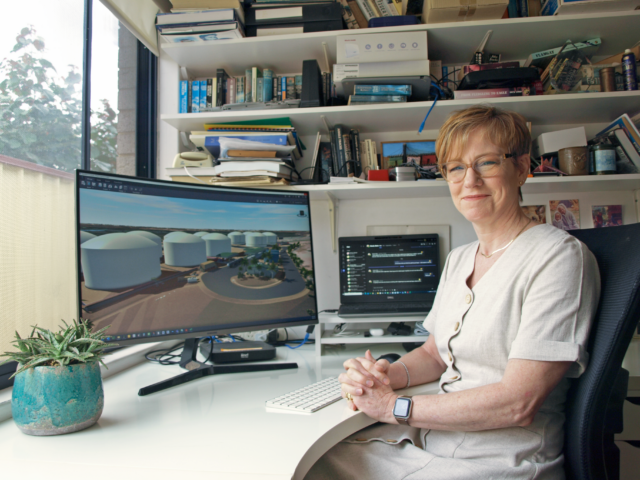
Expert Interview with Wendy Humboldt – Lead Structural Designer

Combining a keen eye in both the artistic and technical fields, Wendy Humboldt has been working at Tetra Tech Proteus for 9 years. In that time, she has combined her artistic background with her skills as a Lead Structural Designer to deliver rendered images and flythroughs of projects to clients, even before construction has begun.
What inspired you to get into this line of work?
It was a little by accident because after I graduated from school, I started a diploma in Graphic Design, but after some challenging circumstances at home, I didn’t finish it. One thing led to another and my father, who is also a draftsman, convinced me that it was a wonderful field to get into. At that stage I was convinced it was going to compromise my artistic principles, but in the end, I was proven wrong.
Once I emigrated to Australia from South Africa, I completed a skills assessment with Engineers Australia based on my work experience and was introduced to the mining industry.
Tell us about the flythrough technology which you have so successfully adopted.
A flythrough is a series of individually rendered still images all tacked together to make a video. The technology has been around for a while now and are used in many industries.
Often it’s a marketing tool, so typically a client wants them for funding or sponsorship at the beginning of the work. If Tetra Tech complete a feasibility study for a client, we will develop a model at the same time. Generally, it’s not the same level of detail as a model that you would produce for construction, but it’s enough.
From the viewer’s perspective, a flythrough is much easier to understand and far more engaging than a static 2D map or image. When I include moving people and animals, it completely changes a person’s perception of what they’re looking at because it gives a sense of scale that you don’t normally get from just looking at a two-dimensional picture of a factory or plant.
How long does it take you to create a fly-through video?
It very much depends on the project, and what the image is for. If it’s just a quick image, generally not more than half a day.
For a more complicated video, it usually requires a few weeks because it requires a lot of fine-tuning. If, for instance, you don’t quite like a particular camera angle, or if you move around the corner and feel a bit nauseous, then you need to redo that. There’s a lot of iterative changes that you need to make to get it exactly right.
What kinds of software do you use?
There are several packages that we’ve used over the years, all with different strengths, but the best quality images I believe are coming out of our Bentley software. Bentley also has its own add-on package for flythroughs called LumenRT, which is very good because it creates a virtual world where you wouldn’t have one, so you can place your model in a scene and create a detailed landscape.
Another product we use from Autodesk is called InfraWorks, which creates the terrain from an internet-based mapping software. The strength of this is that it creates the scene very quickly which, in the case of our Kvanefjeld project, was important because that video was used for public engagement to demonstrate how little impact our plant was going to have on the surrounding environment.
What challenges do you face undertaking this work?
Typically, there’s not a lot of people who have the skills for doing images and flythroughs. Not everybody has that slightly artistic bent or can afford the time. It takes a lot of experience and time to put together data from different sources and make images look realistic; trying to get the right terrain or satellite image working and such. I feel very proud that the team here at Tetra Tech can provide this service to our clients.
It also depends on which software package I am using. For example, LumenRT is an American product and the application’s colour schemes just don’t represent visually our unique landscape here in the Pacific region.
On that, how do you achieve that accuracy? Do you have plans on which to base your imagery?
We do have a library which is made up of work we’ve done previously that we can draw on. For example, we’ve got a mill that may be similar to that job, or a pump that’s a bit like that one and we’ll put them all together to create something quickly. When we first started on the Kvanefjeld project in Greenland, we just did still images out of Bentley software which can be integrated with Google Earth, so the final images of the project were shown in a real space. I was incredibly proud when those images were used in our submission for the Bentley Awards, which won Tetra Tech Proteus first place for Innovation in Mining.


No Comments